Details
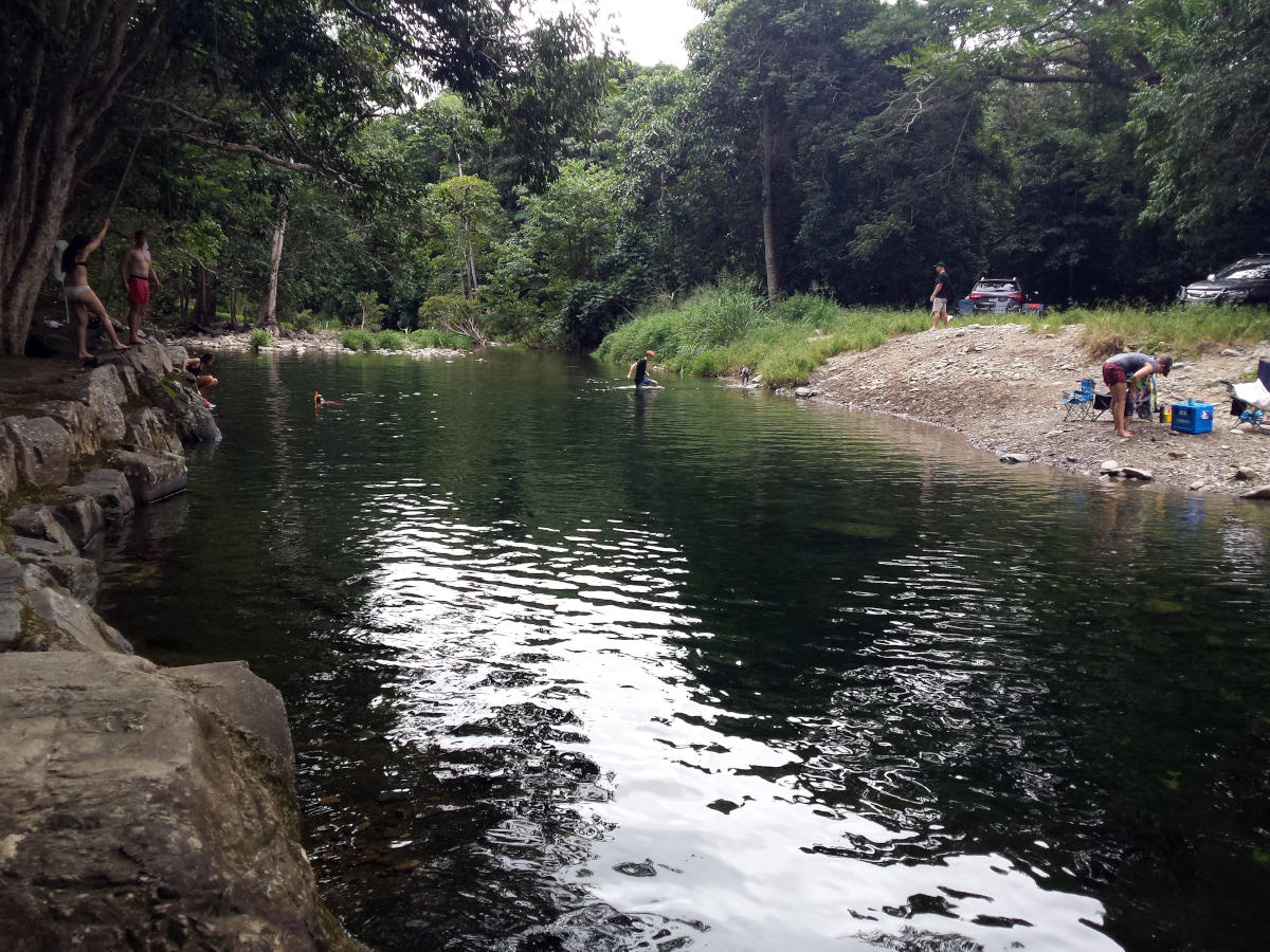
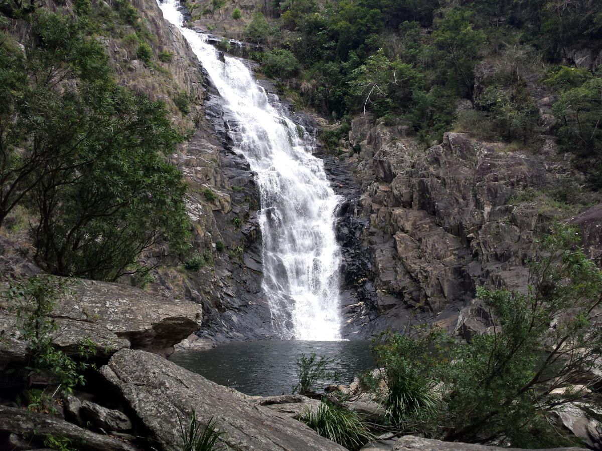
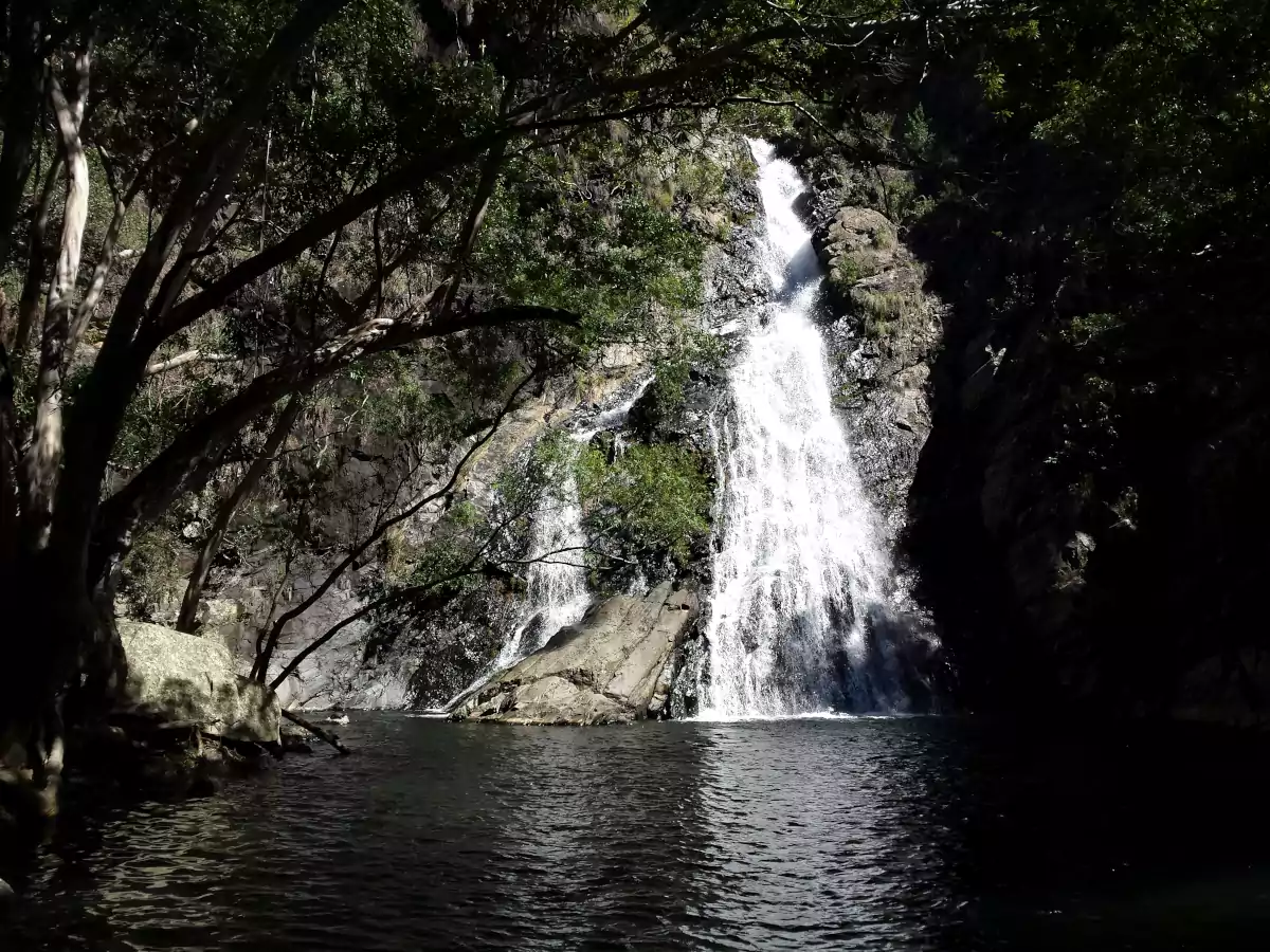
Big Mowbray Falls is located in the Mowbray National Park, south of Port Douglas. There is a small swimming hole / rock pool at the top of the falls. It’s not very deep, but it’s a great place for cooling down after the long hike. This is quite a secluded swimming hole, you wont see too many people here, so if you are looking for a quiet place to swim, then this is it. There is no access to the bottom of the falls, and it’s a very long drop, so please take care.
How to get to Big Mowbray Falls
There are two ways to access Big Mowbray Falls, and both involve hiking.
1. The Bump Track – Black Mountain Road Trail Head (6.2km Round Trip)
The shortest and flattest hike to Big Mowbray Falls, starts along Black Mountain Road, where it intersects with the Bump Track. There is a small dirt parking area with a couple of parking spaces. From the car park, hike along the Bump Track in a north-easterly direction, and take a left turn after 1.4km. The turn-off is not marked, so keep your eyes peeled.
From the turn, it’s another 1.7km to the top of the falls. The hike to Big Mowbray Falls is 3.1km one way from the Black Mountain Road car park, so that’s 6.2km in total there and back.
2. The Bump Track – Connolly Road Trail Head (12.6km Round Trip)
The longer and steeper hike to Big Mowbray Falls, starts at Connolly Road, Mowbray, where it intersects with The Bump Track. From Connolly Road, hike up the Bump Track in a south-westerly direction. The Bump Track is a seriously steep track, but it is mostly shaded, and there is an amazing lookout after the very steep section, about 1.9km into the hike, so that makes it worthwhile.
About 4.1km into the hike, you will come to Robbins Creek, which you will need to cross. There is no bridge, but you should be able to rock hop across without getting your feet wet. The other option is to take off your shoes and have a little dip in the stream to cool down.
About 400m after Robbins Creek, and 4.5km into the hike, you will need to take a right turn. The turn-off is not marked in any way, so keep your eyes peeled. From the turn, it’s another 1.7km to the top of the falls. The hike to Big Mowbray Falls is 6.3km one way from Connolly Road, so that’s 12.6km in total there and back.
Photos

Big Mowbray Falls, Mowbray, QLD, AU

Big Mowbray Falls Swimming Hole, Mowbray, QLD, AU
Map
Sorry, no records were found. Please adjust your search criteria and try again.
Sorry, unable to load the Maps API.